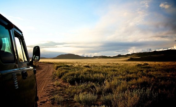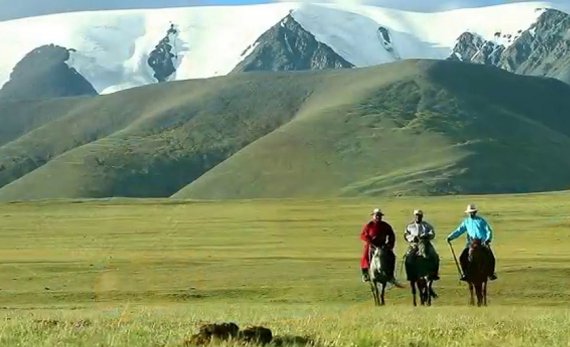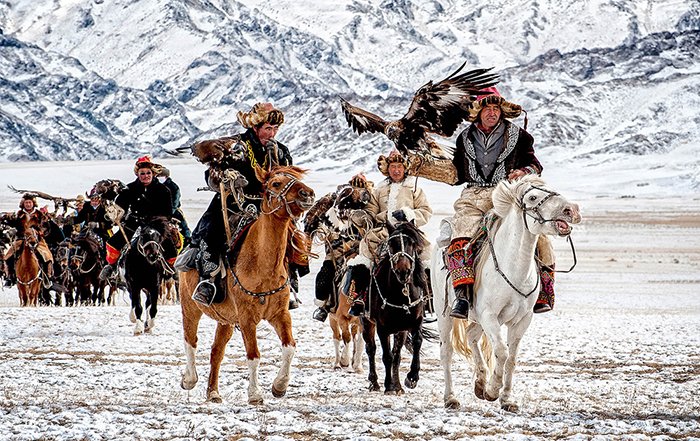
Eastern Mongolia
Eastern Mongolia
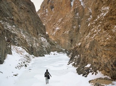
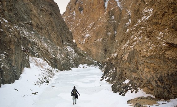
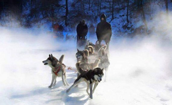
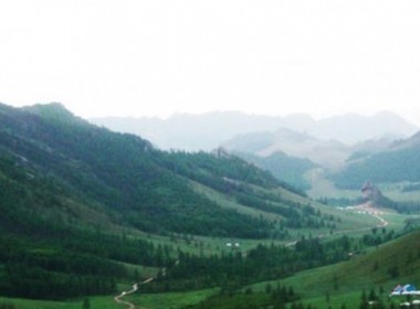
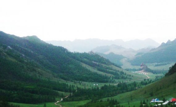
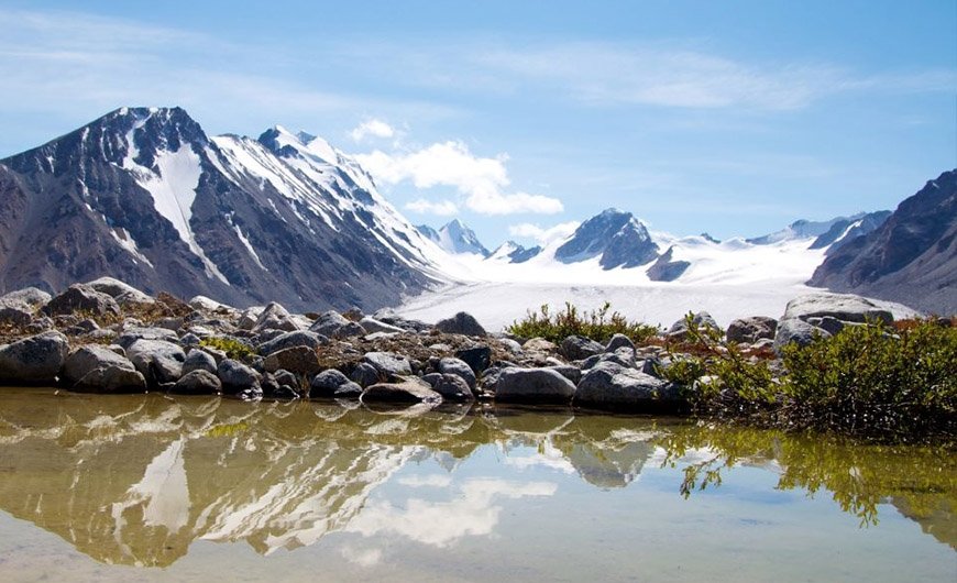
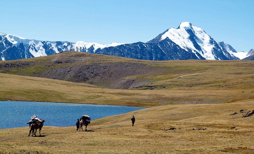
Khan Khentii Mountain National Park
This is the native land of Genghis Khan and contains many important historical and cultural sites. The park is landscape of transition from Siberian taiga forest to grass steppe. Khan Khentii Mountain National Park is one of the Mongolian natural and historical treasures, declared by UNESCO as world heritage site. Khan Khentii is covered with forests, taiga, and mountain forest steppe. It is the land described in The Secret History of Mongols, a literary monument of the nation, and is a protected area located northeast of the capital city.
Oglogchiin Kherem (Oglogch Wall)
Oglogch Wall is located at the base of Daichin Mountain, 45km southwest of Batshireet soum. The wall, 3km in length, is made entirely of stones without the use of mortar. When Russian archeologist S.Kondratiev explored the site in 1926, the wall was 2.5-4.5 meters in height. Today it stands 3.1 meters tall at its highest point. Last summer, Mongolian-American joint expedition team "Genghis Khan" discovered approximately 60 tombs near the wall. The archeologists believe that Oglochiin Kherem may be a burial place of great Mongolian figures, such as Genghis or Kublai Khan.
Kherlen River
The Kherlen is one of the three famous rivers which rise in the Khentii mountain Range, and it flows for 1.264 kilometers to drain into Lake of Dalai Nuur in China . There are many kinds of fishes and birds such as geese, duck, Amur Catfish, Umber, Taimen, Lenok, Amur Chub, Mirror Carp, Golden Carp, & Amur Ide. etc. An honorary monument at Khodoo Aral near the Kherlen River was dedicated to Genghis Khan. Historians write that the khan came to power at Khodoo Aral, an area from which he later emerged to unite the nomadic tribes of Mongolia . Ogoodei Khan and Munkh Khan were later enthroned at Khodoo Aral.
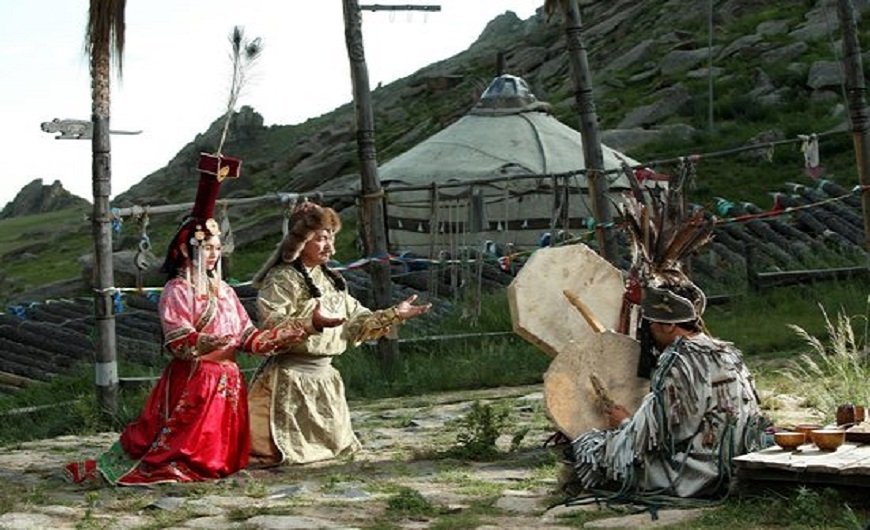
Deluun boldog, Birthplace of Genghis khan
for his 800th birthday, a statue of Genghis Khan was erected in 1962 at Deluun Boldog; a place believed to be the great khan's birthplace, close to what is today Dadal soum, an attractive wooded area in North-west Khentii region. The area contains trails and lakes for visitors as well as monuments where you can learn why this fierce warrior and great leader is still revered today. Dadal Sum once housed one of three great lamaist temples consecrated to Genghis Khan, but which was razed in the 1930s. Now there are stone monuments to him erected in the surrounding beauty of the Mongolian countryside.
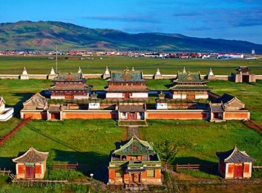
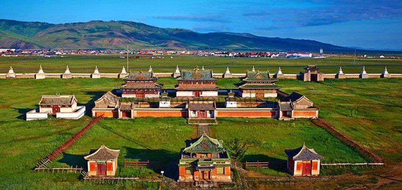
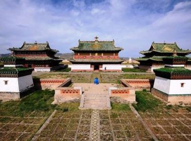
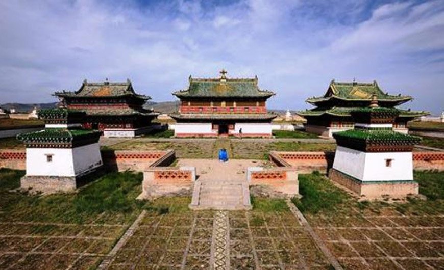
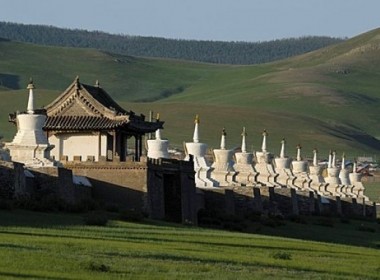
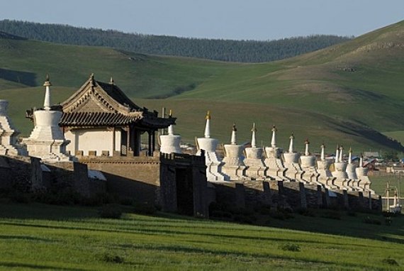
Baldan Bereeven Monastery is a Gelugpa (Yellow Hat) Buddhist monastery located in the Baruun Jargalant River valley Omnodelger district, Khentii Province, Mongolia. First established in 1654, the monastery grew to be one of the largest and most important in Mongolia at its height in the mid-19th century, housing up to 8000 monks. Architecture resembled the famous Utai Gumbun monastery in Tibet. The Tsogchin Dugan was one of the largest buildings in all of Mongolia measuring almost 30 meters by 30 meters and almost 12 meters tall. The monastery and temple complex were destroyed by Mongolia’s communist regime in 1937.The monastery grounds are surrounded by scenic and sacred mountains including Munkh Ulziit, Arvan Gurvan Sansar, Bayan Baraat, and Bayan Khangai, all part of the Khentii mountain range. The four mountains are said to resemble animals: a lion on the east; a dragon on the south; a tiger on the west; and a Garuda on the north. The monastery itself is backed by the steep cliff of Munkh Ulziit Mountains where many cliff carvings, stone carvings with different images of Buddhist gods, inscriptions of religious mantras, and a large Soyombo symbol can be found. By 1850 when its main temple was remodeled, Baldan Bereeven reached its peak as a teaching monastery. It contained four separate colleges and more than twenty temples with a monastic population reaching nearly 8000. Around the year 1900 an epidemic wiped out half of the monastic community leaving between 2000-3000 monks. In 2012 Baldan Bereeven Monastery and the surrounding area were placed on the tentative list to be nominated as a UNESCO World Heritage Site.
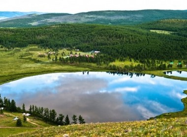
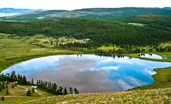
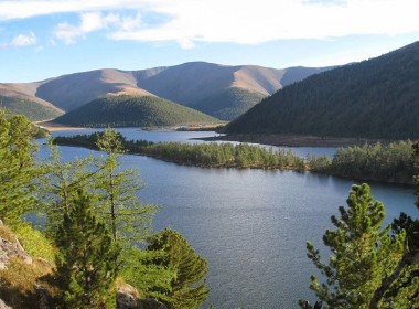
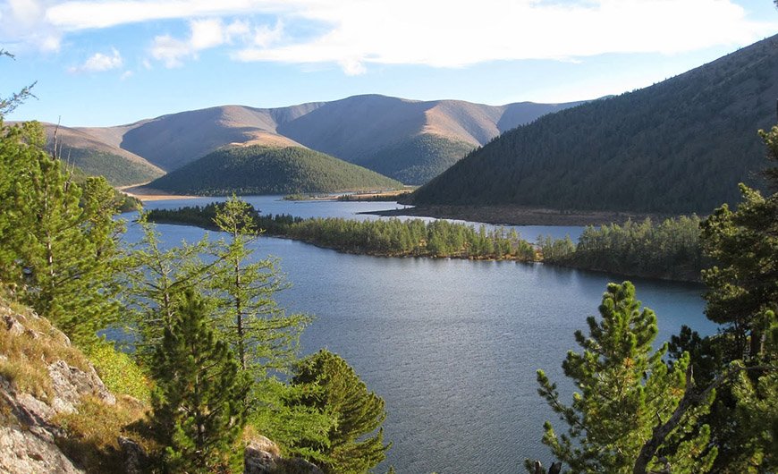
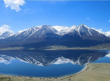
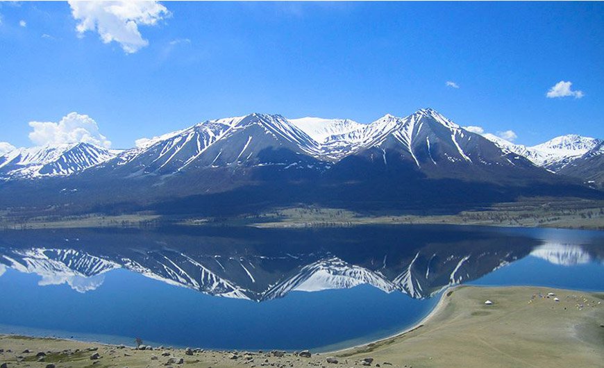
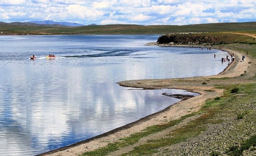
Khukh Lake
It was mentioned that Temuujin (Genghis khan's childhood name) moved to in the Khukh Lake ( Blue Lake ) of Kar Zurkh (Black heart) of Sengur which exists Khurelkh. Khar Zurkh is a point topped mountain with forest in its shady side and no trees in its front slope. The stone of Ger. ruin with diameter of 15 meters is on the south side of this lake. It would be ruin of the Palace where Genghis Khan was was entitled as a Khan of Mongols in 1189 . The land around the lake is a region as a taiga forest zone and vast depression surrounding mountain ranges.
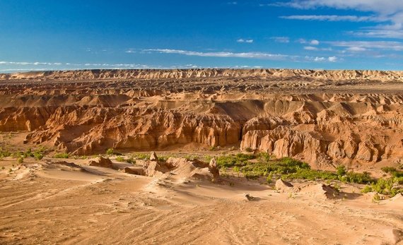
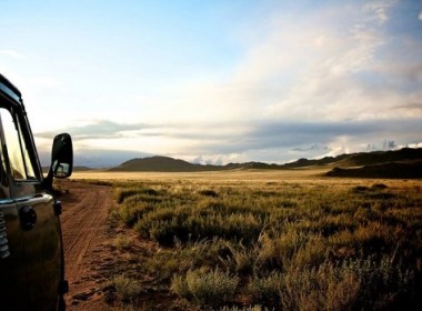
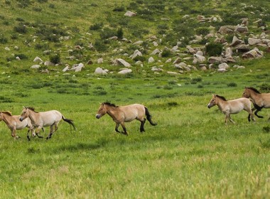
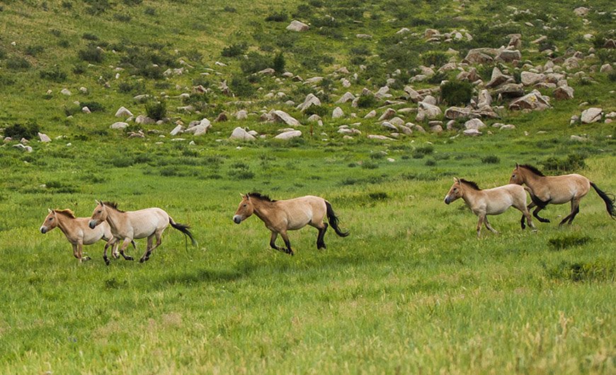
Dornod Mongolia steppe
thankfully, authorities have been convinced that the area's fragile environment and endangered fauna and flora need to be conserved. Dornod is currently the base of a multi-million dollar environmental protection project, which is researching everything from fires to field mice in an attempt to protect one of the world's last undisturbed grasslands. Three large Strictly Protected Areas were established in the aimag in 1992: Dornod Mongol (570,374 hectares). One of the last great plain ecosystems on earth, protecting seas of feather grass steppe and 70% of Mongolia’s white-tailed gazelle, which roam in herds of up to 20,000. Nomrog (311,205 hectares) is an unpopulated area, which contains rare species of moose, cranes, otter and bears. Ecologically distinct from the rest of Mongolia, the area takes in the transition zone from the Eastern Mongolian steppe to the mountains and forest of Manchuria. It is proposed that the park expand eastwards. Mongol Daguur (103,016 hectares). The reserve is divided into two parts; the northern half is hill steppe and wetland bordering on Russia’s Tarij Nuur and Daurski Reserve, protecting endemic species like the Daurian hedgehog; the southern area along the Uuiz Gol protects white-naped crane (tsen togoruu) and other endangered birds. The area is part of a one-million hectare international reserve, linking the Siberian taiga with the Inner Asian steppe.
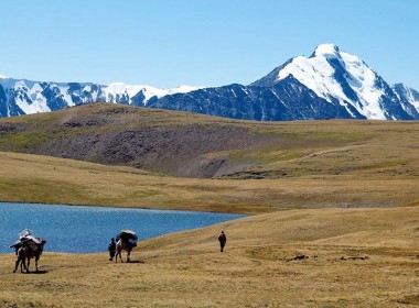
Shiliin Bogd volcano
At 1778m, Shiliin Bogd Uul, about 70km east of Dariganga, is the highest peak in Sükhbaatar aimag. The extinct volcano is sacred to many Mongolians: the spirit of any man (and man only!) who climbs it, especially at sunrise, will be revived. The region is stunning, isolated and close to the Chinese border – so be careful.
A jeep can drive about halfway up the mountain, and then it’s a short, but blustery, walk to the top. There are plenty of ovoos and awesome views of craters all around. About 3km to the south, the fire break that squiggles into the distance is the border with China. If you are camping, Shiliin Bogd offers one of the greatest sunrises in a country full of great sunrises.
On the road between Dariganga and Shiliin Bogd, 8km past Ganga Nuur, look out for the statue of Toroi-Bandi, the Robin Hood of Mongolia, who stole horses from the local Manchurian rulers, then eluded them by hiding near Shiliin Bogd Uul. The statue, dedicated in 1999, pointedly faces China.
Taliin agui
Taliin Agui (Steppe Cave) is the largest cave in Mongolia 14 km to the north of Shiliin Bogd Mountain in Dariganga sum of Sukhbaatar province.
The cave is located in the middle of vast steppe and stretches 200meters in length and occupies in total space of 100.000 cubic meters.
Steppe cave is the creation of volcanic air pressure under the ground. The cave is basalt, considered to be one of the biggest caves in Mongolia and the most beautiful cave of all the 200 caves found around Mongolia. It is peppered with stalagmites and the basalt walls are striking.
Ikh Burkhant Complex
The site called Ikh Burkhant is located on the Western bank of the Khalkh River, 35 kilometres (21.75 miles) north the sum of Khalkh, in the province of Dornod, in the extreme East of country.
On this site, you can see many statues of Buddhist gods, among which the huge one, sculpted right on the hill, of Janraiseg, "Avalokitesvara" in Sanskrit, protective God represented with the legs apart. The local regent Bat-Ochiriin Togtokhtor or Tovan (Van means lord) ordered the statue in 1859; it was erected in 1864, and then renovated from 1995 to 1997.
Tovan and Buddhist lamas erected the statue horizontally on the Western bank of the Khalkh River, in order to symbolize the protection of the oriental border and the security of the country. Building the site was made possible thanks to donations of the people and lamas. The statue is 30 meters (98.43 feet) long, and 1 to 3 meters (3.28-9.84 meters) deep in the rock. It was made with stones carried by 1000 carts pulled by bullocks and 180 craftsmen were required to work on it. Around the statue, 12 stupas and 20 smaller statues representing impressive Gods who're watching prayer wheels were built. You can see on the ground some strange stone representing broken faces and a stone couple that's forever hugging each other.
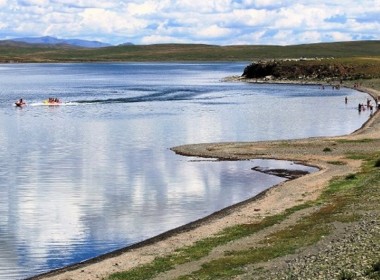
Buir Nuur
Located 285 kilometers from Choibalsan, and at a height of 581 meters, this pretty saltwater lake offers crystal-clear waters and good fishing opportunities. Stretching across Khalkh Gol Sumber sums, this is the largest lake in eastern Mongolia, over 20 kilometers wide and 40 kilometres long. Its north-west shore is in China. Mosquitoes invade this area in summer, so bring plenty of bug repellent and light clothing that will cover your skin. It’s worth noting that the Dornod steppes are reputed for being the home of the fiercest mosquitoes in Mongolia- a shame because Buir Nuur has beautiful sandy beaches and a wide variety of fish, including carp taimen and lenok. Along its shores stand several memorials dedicated to the Mongol and Russian soldiers who died in the battle of Khalkhiin Gol. The largest memorial called Khamar Davaa, is 50 meters tall.
Khalkhiin Gol
Located in the south-east, this area was the site in 1939 of a fierce battle between Japan and a joint force of Mongol and Soviet troops. The Japanese, already in control of Manchuria (which they called Manchuguo), planned to invade Mongolia and set up a puppet state there. The Soviets, threatened by Japanese imperialism in the East, were quick to react and bulked up their forces along the front lines. Hundreds of tanks, canons and airplanes, and thousands of troops, faced one another across the Khalkh River. Although border skirmishes had been going on since 1935, the first serious battle occurred in May 1939. The Japanese were pushed back, but then in July launched a massive ground force. Three battles left 18100 Japanese dead and over 48000 wounded. As for the Soviets, their losses equaled 8900 dead and nearly 16000 wounded. The eighth Mongolian cavalry division played minor role in the fighting, it lost 237 men
The Japanese, now seeing the determination of the Soviets in Mongolia (and therefore Siberia), turned towards South-east Asia. Diplomats representing the USSR and Japan met several times after the battle, finally, in October 1941, all sides signed a document to determine the extent of Mongolian borders. The situation remained tense, however, and huge numbers of Soviets borders guards were strung across the frontier.
The Khalkh River flows though Sumber sum. The main town is Tsagaannuur its 375 kilometres south-east of Choibalsan. The museum where is in town explain in detail the battle of Khalkhiin Gol. A large Japanese cemetery attracts many visitors from that country every year.
Rashaan rock
This is a huge rock with 20 different types of (barely discernible) script carved upon it. Rashaan Khad (Rashaan rock) is a rock with numerous types of ancient rock inscriptions and drawings depicting animals, people and ancient Mongolian tribes’ seals. This rock is located near the east of Binder Ovoo, one of Mongolia’s largest and most sacred religious places. The rock inscriptions are in around 20 different scripts such as Orkhon, Kidan, Arabic, Persian, Mongolian and Tibetan. An ancient tomb dating from BC 20000 lies near this rock and many monuments of Paleolithic Neolithic Huns and others are also found here. The rock has been protected by the Mongolian government since 1998.
POPULAR TOUR

UPCOMING EVENTS